Compaction CPT Boxes
Introduction
The Compaction CPT Boxes feature allows the user to create a set of polygons in plan view and set a compaction condition to each PointID. Upon calling the Add-In menu, it will calculate the PointIDs that fall within each polygon and will give a Compaction Status of the polygon based on that of the Critical CPT that falls in the. It also calculated the Bottom Layer for the critical CPT. The polygons, meta data and defined symbology can be exported to MIF/MID MapInfo Exchange file format. Two sets of files can be made, one for the Compaction Status and second of the Bottom Layer.
To run the calculation select Add-Ins > Datgel CPT Tool > Calculate CPT Box Data.
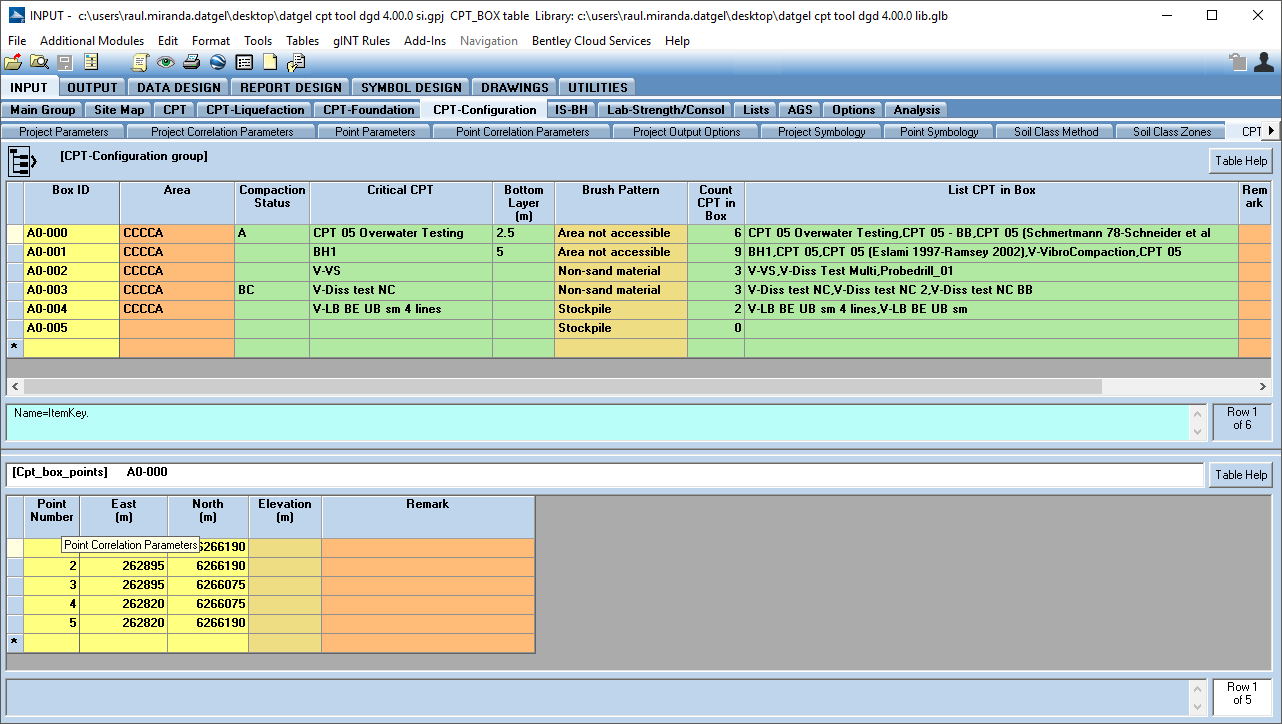
The following fields in the CPT Box table will be calculated according the values stored in the related tables. The Compaction_Status will be populated according the Point.Compaction_Status and Compaction_Status.Priority. The Critical_CPT and Bottom_Layer are populated with the CPT ID, which the Compaction Status is taken from. The Count_CPT_in_Box field is populated with the number of CPT that falls in the Box Id. The List_CPT_in_Box is populated with the names of the CPT that fall in the Box ID.
To ensure a CPT is not used as the critical set a Compaction_Status that has Priority empty/NULL.
If the Bottom Layer concept is designed to help the user map the thickness of a fines layer in a reclamation.
To both calculate and export the data to a MID/MIF files, select Add-Ins > Datgel CPT Tool > Calculate and Export CPT Box Data to MIF/MID. A browser will be opened to choose the destination folder where the files will be saved.
You're a definition of MIF see: http://read.pudn.com/downloads138/sourcecode/others/592839/Mapinfo_Mif.pdf
The following sections include an explanation about the required tables in the database.
CPT-Configuration | CPT_Box
The CPT_Box table stores both the results of the calculations and the coordinates of the CPT Boxes.
In the CPT_Box Points (lower) table the user can define the vertex of each polygon (East and North) and the Elevation if optional. The polygon may be open or close.
The CPT_Box Table (upper) stores the Box Id, user can set up a and the calculated fields by the Add-In (Compaction_Status, Critical_CPT, Bottom_Layer, Count_CPT_in_Box, List_CPT_in_Box). User can define the override Brush_Pattern for exported files.
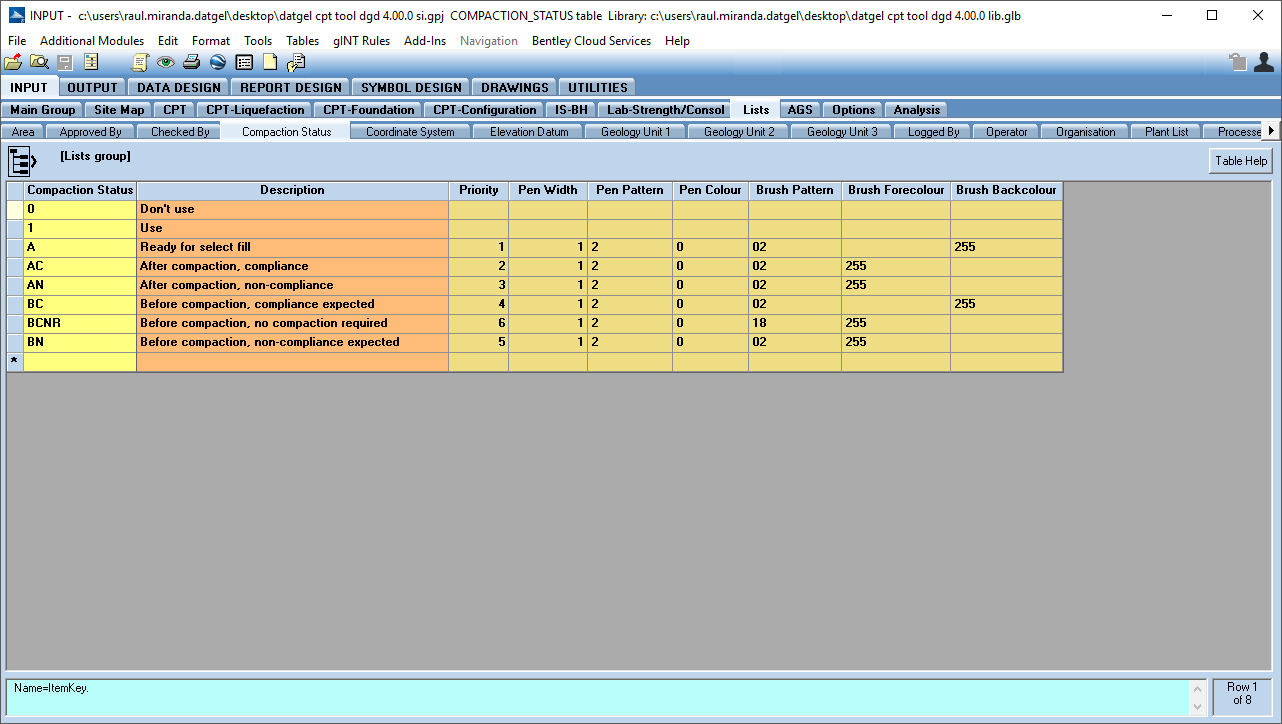
Lists | Compaction_Status
The Compaction_Status table stores the Compaction Status related information. The Compaction_Status will then be used in a lookup list on Point table where the user may define the Compaction Status of each PointID. The Priority field used by the code to decide the Critical CPT.
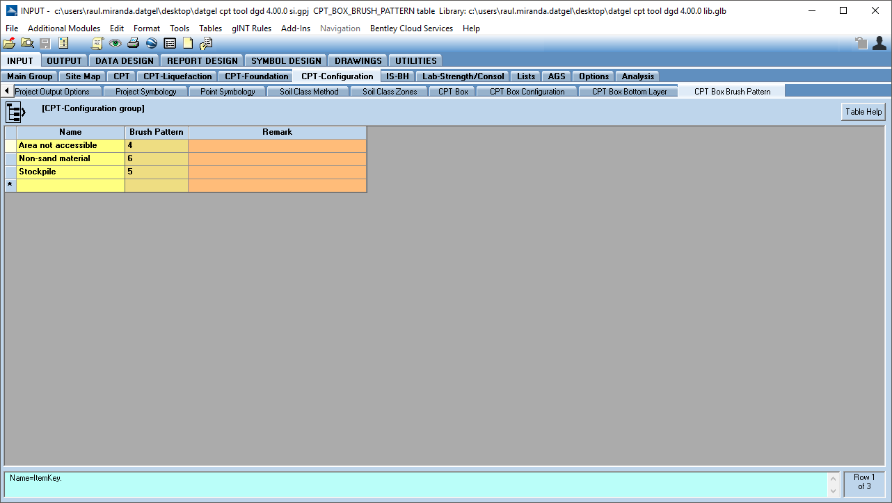
CPT-Configuration | CPT_Box_Brush_Pattern
The CPT_Box_Brush_Pattern table stores a custom list of Name and the Brush Patterns. The Name will then be used in a lookup list on CPT Box table where the user may define the override Brush_Pattern of each Box ID, which is only used if the compaction status is not set for the Box, generally because there are not CPTs in the box.
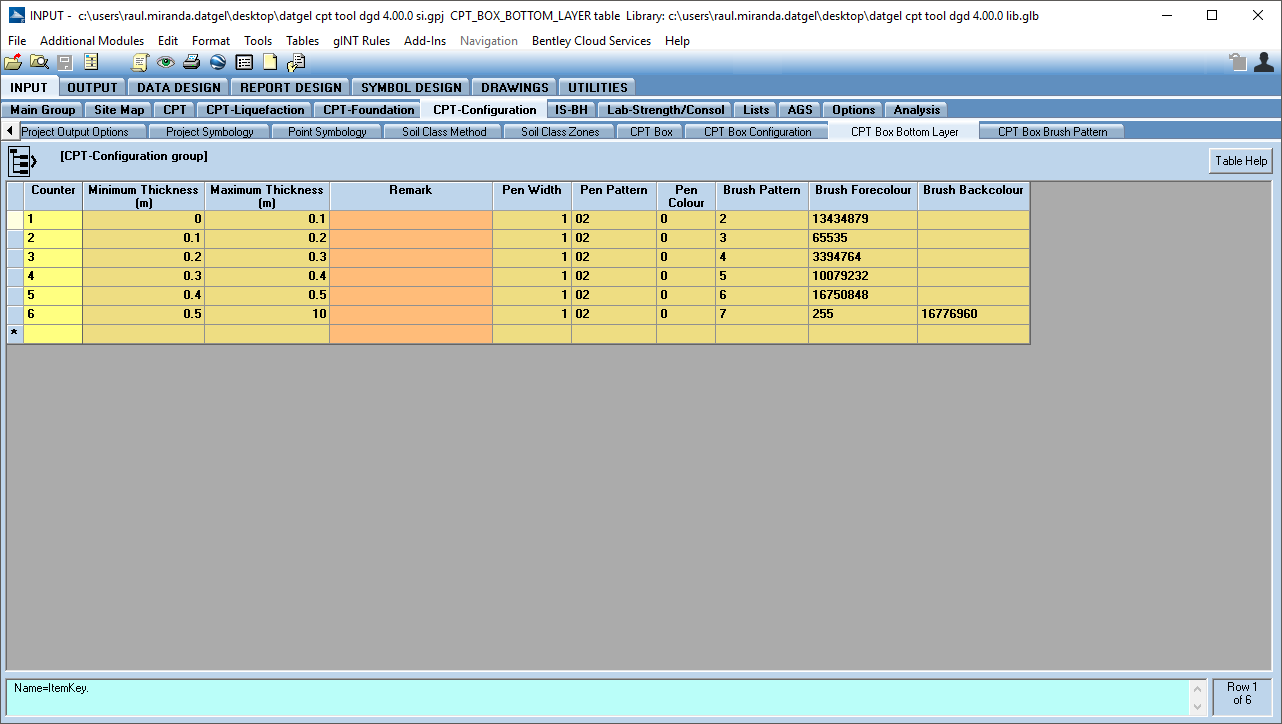
CPT-Configuration | CPT_Box_Bottom_Layer
In the CPT_Box_Bottom_Layer table the user may define the Minimum_Thickness and Maximum Thickness of layers and set up an output features. The user may enter the Layer_Bottom in Point table and the stored output features will be used during the Export process.
CPT-Configuration | CPT Box Configuration
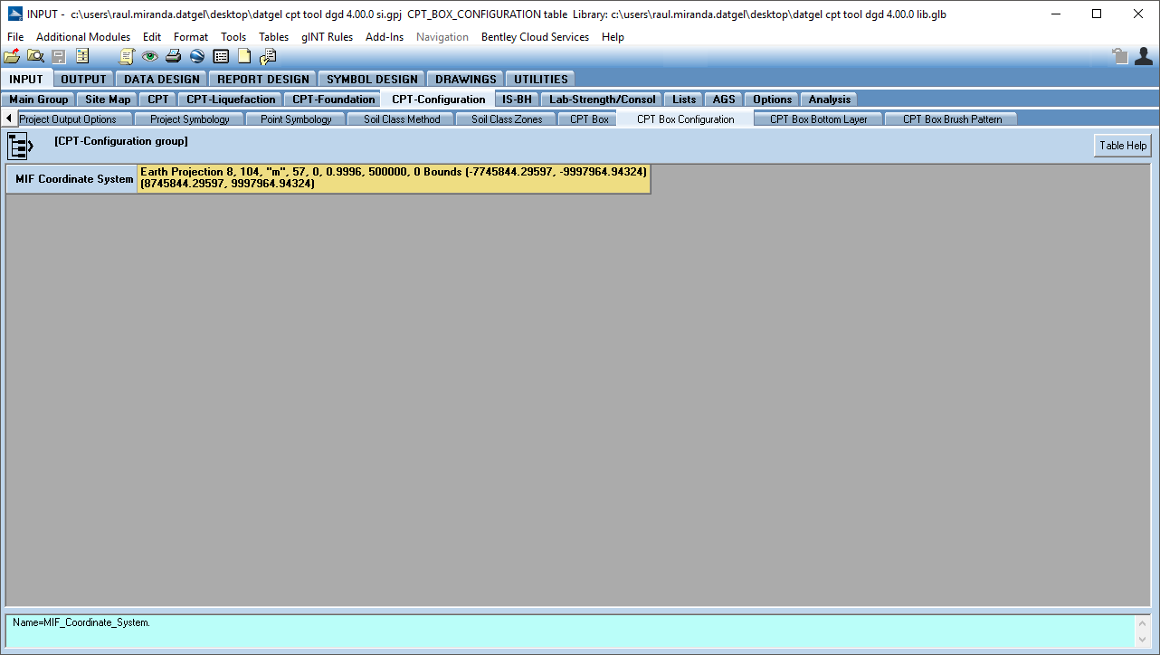
The CPT_Box_Configuration table stores the information related to the MIF Coordinate System.