Using Site Map Reports
Overview
The DFMT includes 11 smart site map reports, that automatically fit the select PointIDs to the page and round up to the next proper scale, like 1:1000. The Maps have dynamic scale bars and data marker legends. There are various page sizes and page orientations.
Input
If your project has a high density of PointIDs, then you may have a problem with PointID labels overplaying on Site Map reports. By default the PointID label will display at 12 o'clock, i.e. above the data marker. You may manually override the PointID label position by setting the analogue clock position in the project field POINT.Map_Post_Position.
For example:
- 6 represent 6 o'clock and displays below the data marker
- 10:30 represents the time of 10:30 and displays to the top left the data marker
Output
Site maps of a range of page sizes and orientations have been set up, and they all operate the same way.
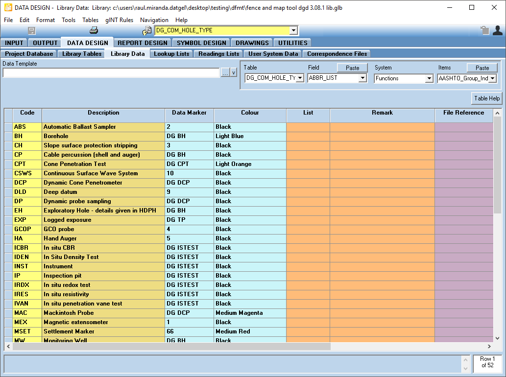
Data markers have been defined for each Hole Type in the DG_COM_HOLE_TYPE library table. gINT creates the map key based on the hole types in the given project and the info in the DG_COM_HOLE_TYPE library table.
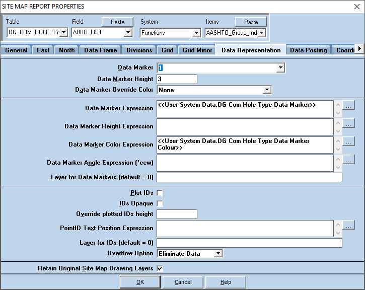
Sometimes you may need to change the way the data marker is displayed. You can do this, as a one off, in the OUTPUT Application group by:
- Select the Properties button
 to bring up the Site Map Report Properties
 - Select the Data Representation Tab
- Here you can edit data marker, height, colour, turn on and off the ID plotting and if the IDs are opaque (halo that prints around text)
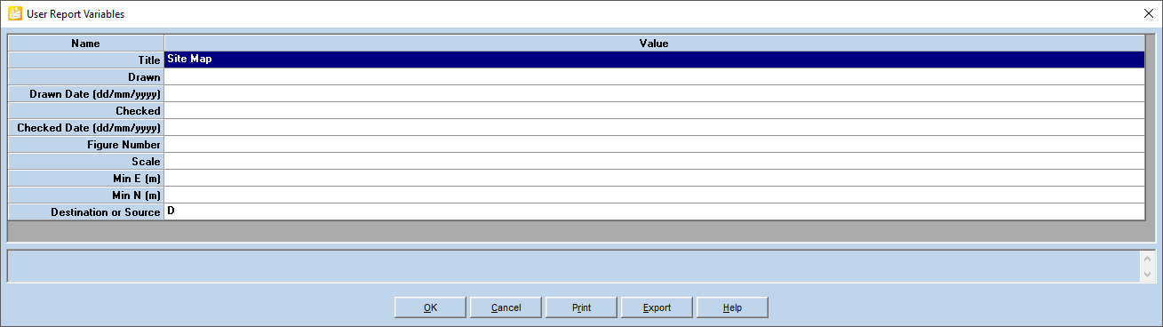
User Report Variables
The user report variables can be used to define the details of the title block and the properties of the site map report. A list of the user report variables and an explanation of how they are used is provided below in Table.
Name | Value | Notes |
|---|---|---|
Title | Site Map | Report title |
Drawn | Enter person's initials/name | |
Date Drawn | Enter date | |
Checked | Enter person's initials/name | |
Date Checked | Enter date | |
Figure Number | Enter text. If left blank, it will default to "Figure 1". | |
Scale | 1 (for 1:1000) | Overrides the scale of the site map by the selected value. |
Min E (m) | Overrides the coordinates of the lower left hand corner of the site map to the specified coordinates. | |
Min N (m) | ||
Destination or Source | D | Defines if the Destination E/N (primary East and North fields) or Source N/E will be used by the map. Only applies to DGD databases. |