Downhole Survey
Overview
This tool calculates the North, East and Elevation values for a given depth, orientation and plunge.
Use
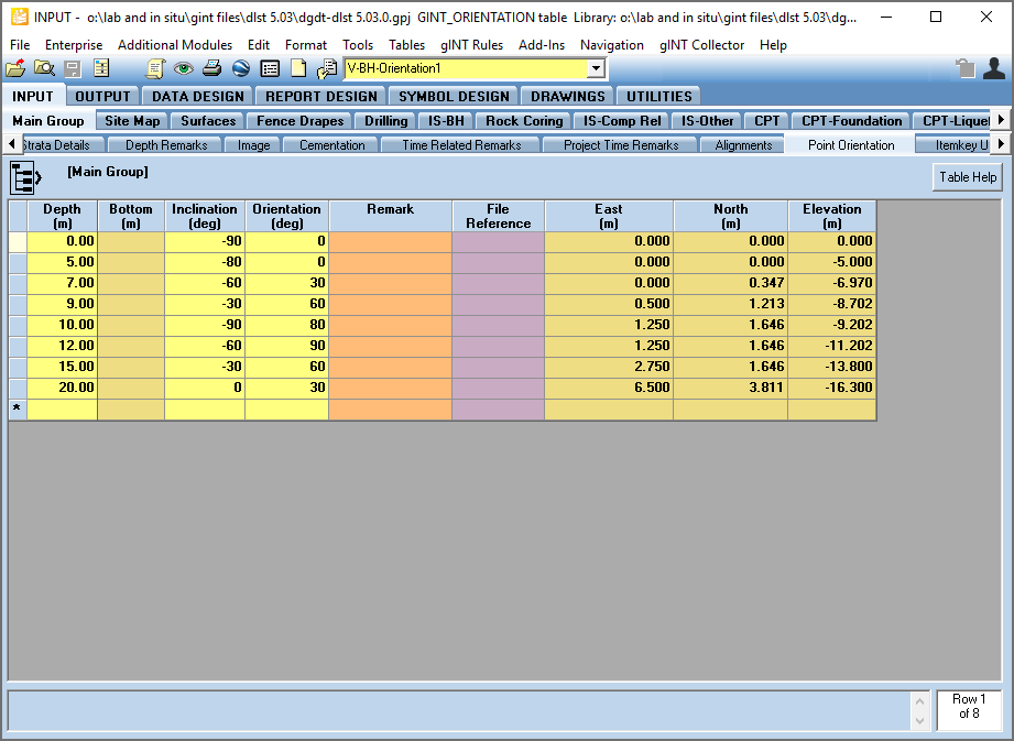
Data from a directional drilling is stored on Point_Orientation table. Add Depth, Inclination and Orientation. Once you entered the data click Save or Ctrl+S and North, East and Elevation fields will be calculated. The screenshot bellow shows an example included in the DGD Tool gINT Files.
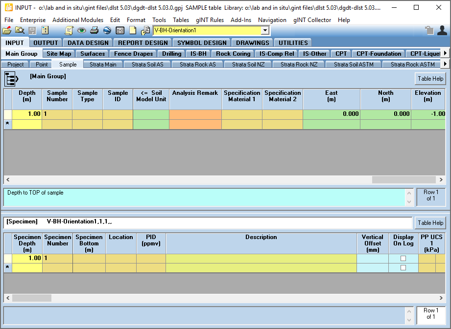
Also, the North, East and Elevation values are calculated in all tables that contain these fields. For example the Sample table.
Alternatively, go to Add-Ins > Datgel DGD Tool > Downhole Survey and the calculation will take place for all PointID's stored in the database.
Considerations
- If there is data on Point_Orientation table, it is used, else it uses Point.Orientation and Point.Plunge
- North, East and Elevation on Point_Orientation are calculated, if there are records on Point_Orientation.
- Point.East_Traverse_End, Point.North_Traverse_End and Point.Elevation_Traverse_End are calculated for the Point.HoleDepth
- North, East and Elevation fields on any Depth related table will be calculated.
- Calculation takes place:
- Add-in command – will calculate every PointID for orientation table and depth tables
- Upon leaving a given depth table after making an edit, it will calculate all PointIDs for that table
- After editing the Point table, orientation data (field on Point_Orientation and Point) will be calculated for all PointIDs
- After editing the Point_Orientation table, orientation data (field on Point_Orientation and Point) and all Depth related tables will be calculated for that PointID
On this page