Database Structure
Overview
The project database tables are grouped and ordered in a logical way, with borehole-related table groups first in the list, followed by in situ testing, lab testing, and then other tables.
gINT Files
The Lab and In Situ Tool package includes the following files:
- Project file:
- dlst X.XX.X si.gpj - Datgel native database structure.
- gint std us lab dlst X.XX.X.gpj - gINT standard project file, with Consolidation Test incorporated. English unit system.
- Library file:
- dlst X.X.X lib.glb - Datgel Library file, supports all tests described in this document in SI unit system.
- gint std us lab dlst X.XX.X.glb - gINT standard library file, with Consolidation test reports included. English unit system.
- Data template:
- dlst X.XX.X.gdt
- gint std us lab dlst X.XX.X.gdt
- Also, a set of gINT correspondence files ( .gci and .gcx) are included.
Unit System
The Lab and In Situ Tool test calculations code has been developed to work with the SI Unit System. Furthermore, the One-dimensional Consolidation test is also configured to work with the English Unit System.
Logo
The logo on all reports is controlled by the field PROJECT.Office. This allows the library to be configured with multiple organisation brandings, and you can easily select the required branding.
See section Configuring Logos in the Library for further details.
Project table
Main Group | Project
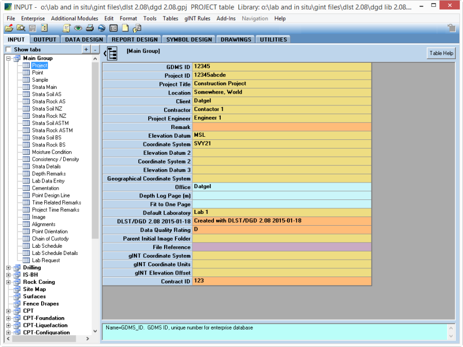
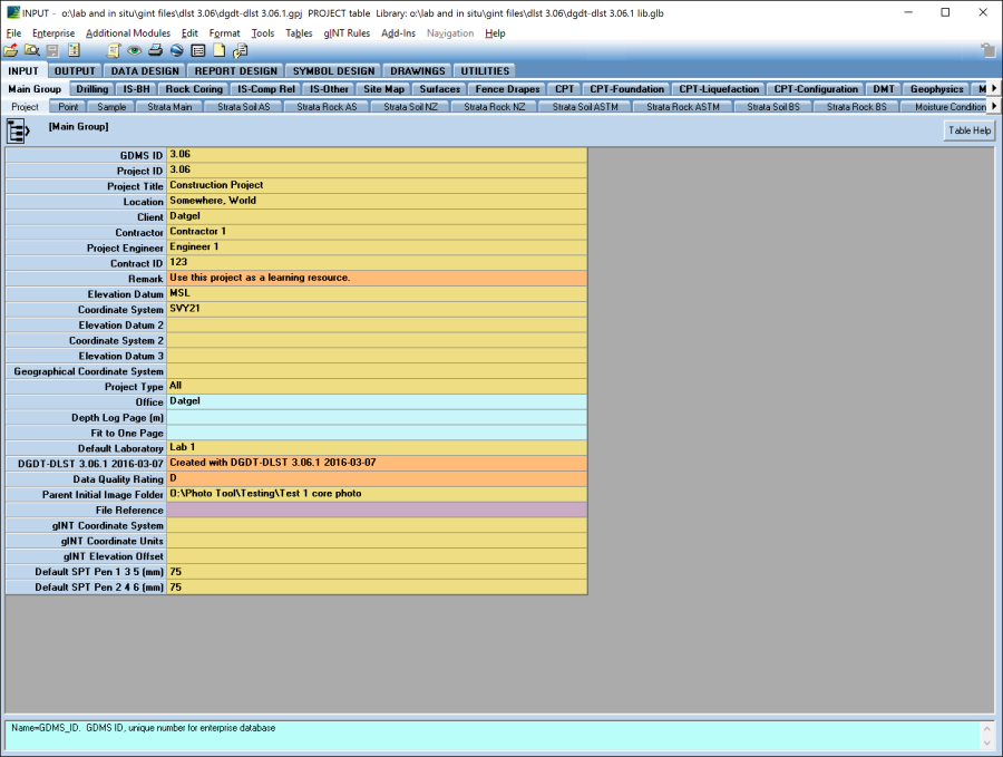
The PROJECT table stores general metadata about the project, such as Project_ID, Name etc, and some Lab and In Situ Tool configuration information.
The following fields typically appear on lab test report sheets, and normally should be entered for each project: Project_ID, Project_Title, Location, Client, Contactor, Project_Engineer, Elevation_Datum, and Coordinate_System.
Some other Lab and In Situ Tool Specific fields are:
- Office – this is a look up to the DG_COM_OFFICE library table, and controls project/office specific report settings such as logos.
- Density_of_Water Lab – Used by lab tests as required
- Classification_Standard – defines the standard used for automatic soil descriptions stored on the SPECIMEN table.
- Default Laboratory – the value in this field is used as a default on lab test tables for the Lab Name field.
Point table
This table stores the definition of a sample location, this could be a borehole, test pit, sample from a stockpile or barge etc. You must create a PointID here before moving to the Sample table, and you must provide a Final Depth which can be 0 in the case of a stockpile sample.
You should enter all available metadata for a PointID. For example, East and North which will allow you to produce maps of Point locations.
A number of fields on the Point table are displayed on lab test report sheets. The Type field controls the information that will display in the header of a report sheet.
Fields such as Logged_By, Checked_By etc normally refer to the test pit or borehole logging data, further each lab test table has fields for this type of information which would specifically relate to the given test only.
The fields Specification_Material_1, Specification_Material_2, and Display_Specification_Material_2 On_Reports are explained in section Specification Test Analysis.
Samples and Specimens tables
Main Group | Sample
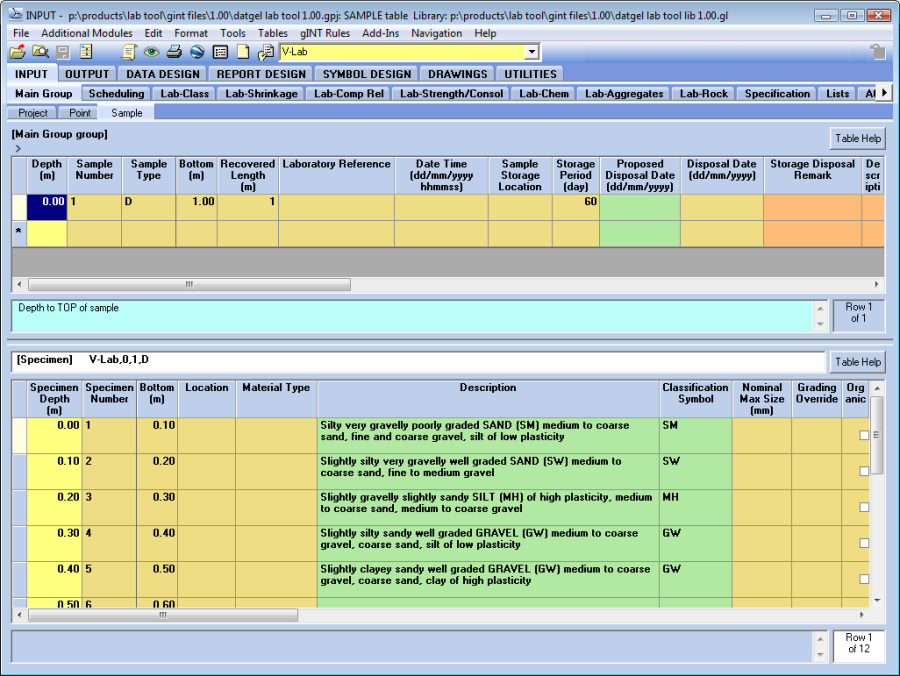
Before entering data for a lab test the parent data in the Point, Sample (upper) and Specimen tables must be entered. The Specimen table is the lower table on the Sample tab.
Each lab test is a one to one child of a Specimen record, such that only one test can be recorded against a given specimen. To undertake a second test on the same sample, you must create a new specimen.
Lists
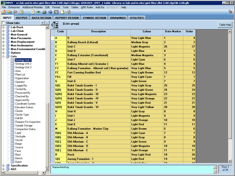
Lists that you expect to vary between projects are stored in the Lists table group. More fixed lists are stored in the library, as Lookup Lists, Library Data, and Symbols of various types.
Option Tables
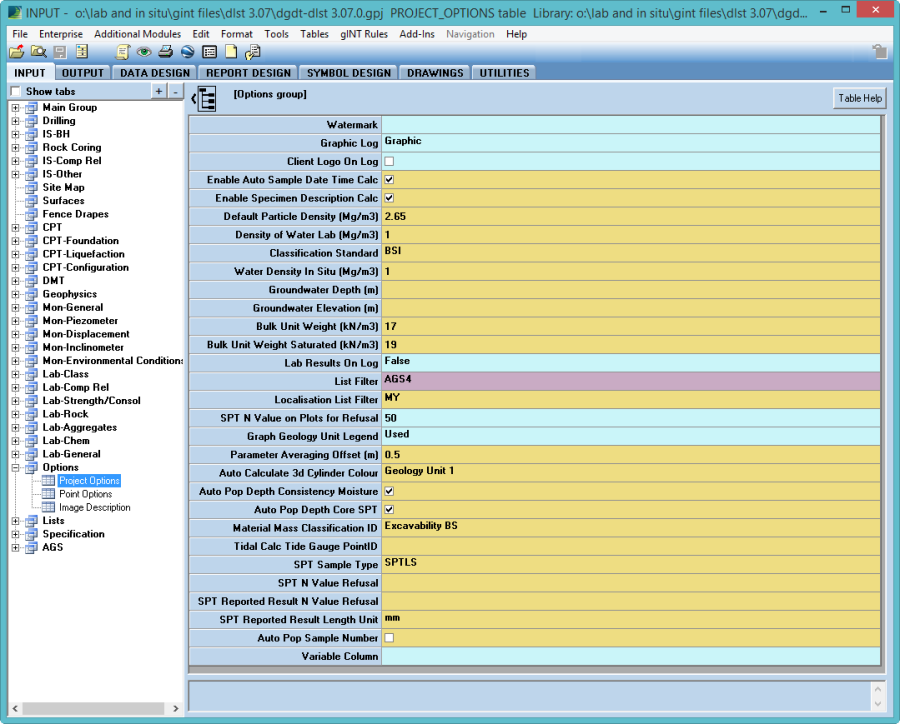
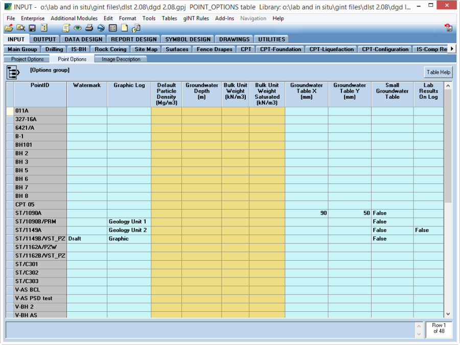
The PROJECT_OPTIONS and POINT_OPTIONS tables are stored under the Options table-group.
If a Point level option is configured, then it will be used in precedence over the Project level option.
The Graphic_Log fields control which graphic source will be used on log reports, the options are:
- Graphic – sourced from STRATA_MAIN.Graphic
- Geology Unit 1 – sourced from STRATA_MAIN.Geology_Unit_1
- Geology Unit 2 – sourced from STRATA_MAIN.Geology_Unit_2
